United States Data Package

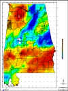
al_tmi.jpg (292035 bytes)

Sample RTP image

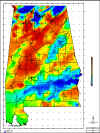
al_grav.jpg (384360 bytes)

Sample Bouguer gravity image

Our  featured data products are the United States and Canada compilation packages. The U.S. package covers the entire lower forty-eight and Alaska; the Canada package covers from British Columbia to New Brunswick. Both are available now. Each package comes with all of the following products:
  • Total magnetic intensity map
  • Reduced to pole magnetics  (RTP) map
  • Horizontal gradient of RTP map
  • Vertical gradient of RTP map
  • Second vertical derivative of RTP map
  • Bouguer gravity map
  • Vertical gradient of Bouguer gravity map
  • Digital elevation model at 100 meter spacing

All of the above products will be produced on heavy bond paper, in color. Additionally, the digital data will be provided in ASCII format. Because of the volume of the data, everything will be provided on either DVD or external hard drive.

This package is on sale for $28,000 for either country, or $46,000 for both.

  • If you aren't focused in the United States or Canada, please click below on CONTACTS and let us know where you are working. E-mail or phone us with your data request and we'll get to work on it.

BD14579_.GIF (267 bytes) Back to Centennial's home page

WHAT WE DO      WHAT'S NEW     PUBLIC DOMAIN PROJECTS     FEATURED DATA       PRESIDENT'S RESUME    CONTACTS